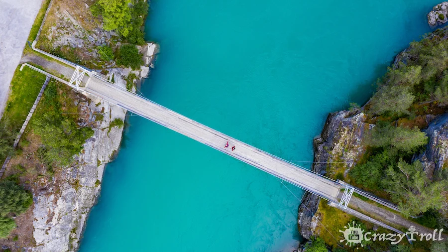
The suspension footbridge across the blue river Finna in the Ottadalen valley definitely deserves your attention! Finna river is of glacial origin and the water in it is turquoise, and the fast current mixes the water and creates a glowing effect from the inside.
The Bridge is located next to the Rv15 highway. Just near the bridge, there is a great rest stop with a parking lot – Nesset Bru Rasteplass, a great place for a short stop or even camping, but don’t forget to follow rules on wild camping in Norway.
There are many rest-stops in Norway and we even made a map, but this one is extraordinary due to the blue river nearby, a lot of space, toilets, cozy tables for your convenience, and a playground. So if you pass by, be sure to stop, enjoy the color of the water and take a couple of photos!
But remember, you can’t jump or swing on the bridge!
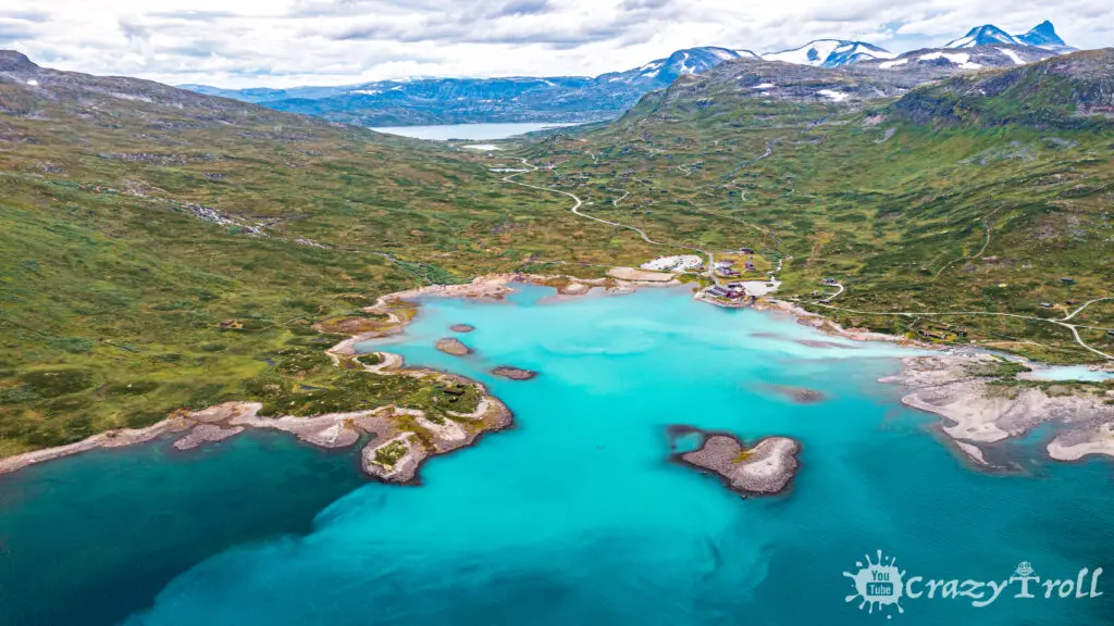
In the western part of the largest lake in the Jotunheimen Highlands, Lake Bygdin, near Eidsbugarden hotels, you can observe an unusual natural effect, reminiscent of watercolor paint that has fallen into the water when rinsing a brush.
It is a rare phenomenon and occurs only when the river flows directly from under the glacier and carries a large concentration of glacial silt in its waters. When such a river flows into the lake, mixing occurs and such a picturesque effect, from which it is impossible to take your eyes off.
Also, several times a day, the pleasure boat M/B Bitihorn departs from the pier near the Eidsbugarden Hotel, which runs across the lake, and from its engine the mixing effect will accelerate and take on new forms.
When visiting the blue lakes, you will certainly want to take a boat or kayak ride on them, as this is an unforgettable experience! After all, if you look into the water in sunny weather, it will not be transparent, on the contrary, it will seem that the light comes from the depths.
Of course, you can use expensive kayaks and boat rentals, but on the blue lake of Oldevatnet, you can do it completely free of charge! Stay at one of the campsites along its coast, such as Oldevatn Camping or Gritta Camping.
They offer their guests a ride on a boat, kayak, or canoe, and this entertainment is already included in the price of an overnight stay! Reservation is not required, and a life jacket and paddle will be given to you at the reception!
But don’t forget to pack your gear in something waterproof!
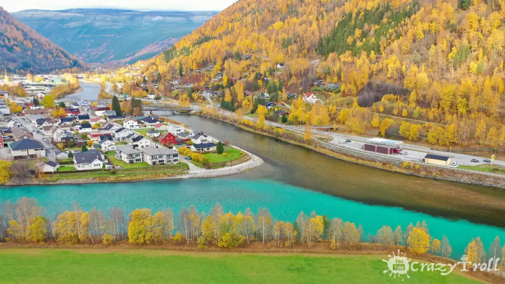
The confluence of two rivers near the city of Otta
The confluence of the Otta and Lågen rivers near the city of Otta
In nature, there is such an unusual effect when rivers with different colors of water meet and dance together without mixing. This is due to their different densities. In Norway, such beauty can be seen near the city of Otta and it is really very unusual and bright!
But of course, this natural phenomenon is most noticeable in August or even in autumn, since the Utta River is of glacial origin and during the summer it gains a large concentration of glacial silt, which gives it a rich and bright turquoise color.
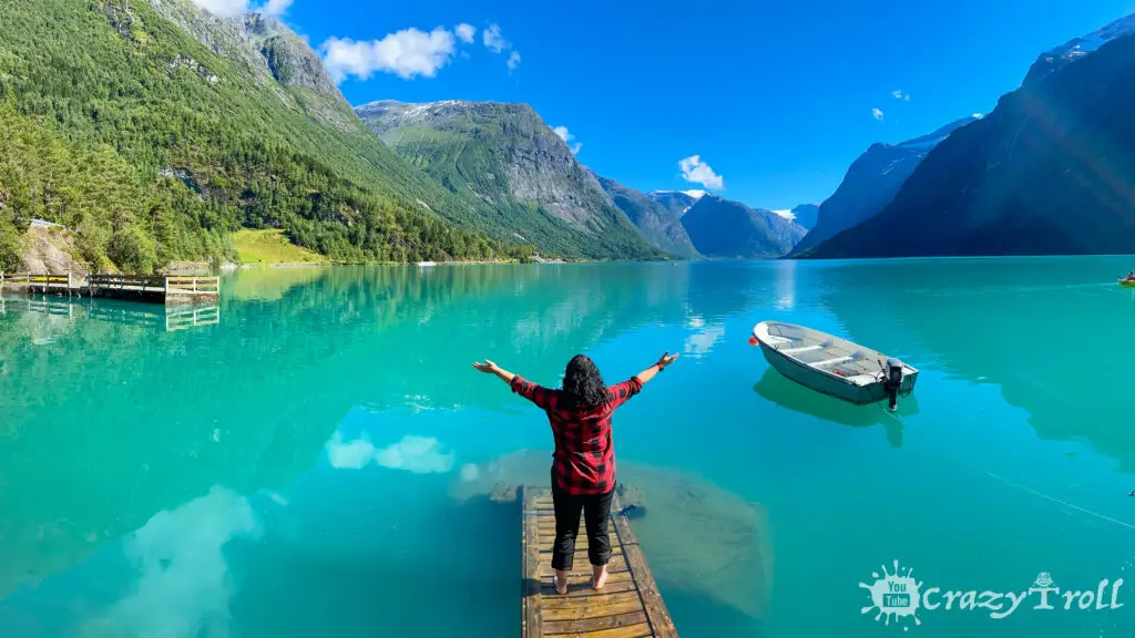
A small bridge leads into the infinitely blue waters of Lovatnet Lake against the backdrop of mighty mountains and glaciers.
Instagram is full of such photos because this is a full-fledged postcard place! And of course, you will also want to take such a photo!
This beautiful place is located almost at the very beginning of the lake, near the Loenvatn holiday center, near the water. Focus on the tied boat and the big rock
But remember that for good photos it is better to arrive there around noon when the sun is still high and the shadow from the mountains does not lie on the lake.
Also in summer, for the sake of photography, you will definitely have to wet your feet in the very cold water of the lake. But in autumn there is less water in the lake and the bridge is on its surface!


")

